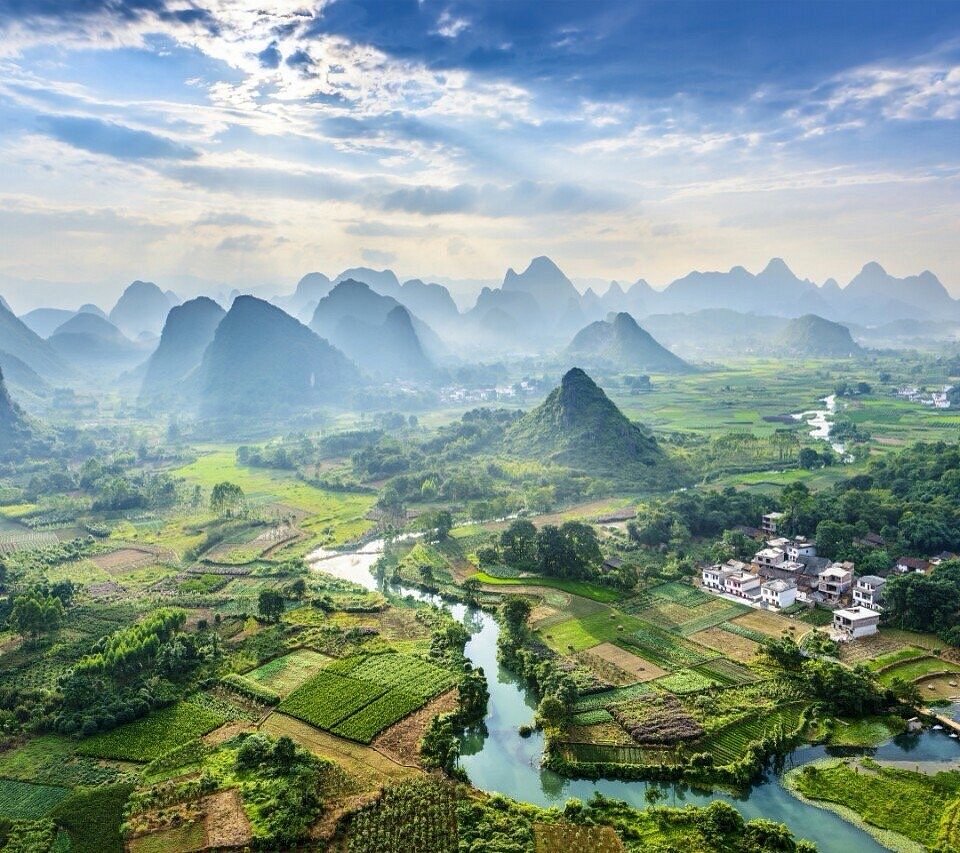
A plain ringed by layers of pointed peaks, with a winding river, fields and a village below.
Vietnam stretches about 1,650 km from north to south. High mountains line the borders with China and Laos in the north, cool highlands sit in the middle, and a long coastline runs down the east side. Weather and scenery change a lot from one region to the next.
In the south, the highland city of Da Lat stays cool all year, and the hills around it grow coffee and tea. The northern mountains are home to ethnic minority villages and rice terraces cut into the slopes. Both have long climbs and plenty of heat, and an e-MTB that helps on the hills leaves you more energy to enjoy the view.
This guide starts with the signature Da Lat Coffee Loop and covers five regions, from the southern highlands and coast to the mountains of the north, with the roads and sights of each.
Lam Dong highlands · Da Lat at about 1,500 m
Da Lat Coffee Loop
- Distance
- About 50–65 km
- Time
- Day trip
- Surface
- Paved road plus red dirt tracks
- Level
- Intermediate
Da Lat sits on a plateau at about 1,500 m and was found by the French in the late 19th century and developed as a hill station to escape the heat. It stays cool even at midday, earning the name 'city of eternal spring', and French-style villas and pine-covered hills still dot the town.
Vietnam is one of the world's biggest coffee producers, and the highlands around Da Lat grow a lot of arabica, which likes the cool climate. The ride east over the hills to Cau Dat, where coffee and tea farms gather, is a steady series of ups and downs. Many farm tracks between the hills are bare red earth, where a fat-tyred e-MTB is a real help.
Stop at a farm cafe for a coffee and the day slips by. From late autumn into early winter you can see people picking the ripe red coffee cherries.
Things to see
Cau Dat tea and coffee farms
Hills where tea has been grown since French times, with green rows rolling along ridges at around 1,600 m. Come early in the morning to see mist lying in the valleys.
Xuan Huong Lake
A lake in the middle of Da Lat with a path all the way round. Good for an easy spin before you set off or after you return.
Da Lat railway station
An old station built in the 1930s, with a distinctive roof of overlapping triangular peaks. A short tourist train still runs from here.
Langbiang Mountain
The mountain north of Da Lat, with its highest peak at about 2,167 m. The area around it is a UNESCO Biosphere Reserve, and the ride out to the villages at its foot is scenic too.
Lam Dong highlands · about 1,000–1,500 m
Da Lat Pine Forests and Waterfalls
- Distance
- About 40–70 km per day
- Time
- 1–2 days
- Surface
- Paved road plus forest tracks
- Level
- Intermediate
Da Lat is nicknamed the 'city of pines', and the hills around it are covered in pine forest. South of town, lakes and waterfalls lie among the trees, and there are many dirt tracks through the forest that you can ride.
Tuyen Lam Lake, close to town, is a large lake ringed by pine hills, with the Truc Lam Zen monastery on a hill above it. A little further south is Datanla waterfall, and around 30 km south-west, near Nam Ban, is Elephant Falls.
The main roads up and down the plateau carry a lot of trucks and buses, so link forest tracks and village lanes where you can. A day of riding through the scent of pine and resting at waterfalls shows a different side of Da Lat from the coffee loop.
Things to see
Tuyen Lam Lake and Truc Lam monastery
A temple on a hill overlooking the lake, with well-kept gardens. You can also cross to it by cable car from a hill on the town side.
Datanla waterfall
A forest waterfall close to town. You reach it down steps into the valley, so leave the bike at the top and walk.
Elephant Falls
Water pours in a wide curtain over dark rock, at its fullest in the rainy season. A temple with a large Buddha statue stands right beside it.
South-central coast · near Phan Thiet, 0–100 m
Mui Ne Coast: Dunes and Fishing Villages
- Distance
- About 40–70 km per day
- Time
- 1–2 days
- Surface
- Paved coast road
- Level
- Beginner
Mui Ne is a seaside village about 20 km east of Phan Thiet. Come down from the Da Lat plateau at about 1,500 m and the air suddenly turns hot, and palm trees and sand dunes replace the pines. It is one of the drier parts of Vietnam, with many clear days in the dry season.
The coast road has little climbing and is easy riding. Past the red dunes and the fishing village, further north-east, are white dunes wrapped around a lake. Wide fields of cactus-like dragon fruit line the roadside.
From about November to March the wind is strong and kitesurfers fill the bay. On windy days, ride the long leg with the wind behind you, and on the way back pick a road a little inland from the shore.
Things to see
Red sand dunes
Reddish dunes close to the village. The sand glows redder at sunset, and the top looks out over the sea.
White dunes and Bau Trang lake
Wide white dunes further north-east of Mui Ne. A lake with lotus flowers lies below them, so you see desert and water together.
Fairy Stream
You walk barefoot up an ankle-deep stream, between cliffs of red and white sand.
Mui Ne harbour and Po Sah Inu towers
In the morning the harbour is full of round basket boats, with fish being bought and sold. On a hill toward Phan Thiet stand red-brick towers built in the time of the old Champa kingdom.
Northwest mountains · about 300 km from Hanoi
Mu Cang Chai Rice Terraces
- Distance
- About 40–60 km per day
- Time
- 2–3 days
- Surface
- Paved pass road plus village gravel
- Level
- Intermediate
Mu Cang Chai is a mountain district about 300 km north-west of Hanoi. Rice terraces carved into the slopes over generations by the Hmong climb every valley to the hilltops, and many people consider them the most beautiful rice landscape in Vietnam.
On the way you cross Khau Pha, one of the longest passes in the north. The pass road runs for about 30 km and climbs above 1,000 m, and from the top you look down on the paddies of the Tu Le valley. Even on an e-MTB, crossing the pass and touring the villages among the terraces in one day takes careful battery planning.
The terraces change with the seasons. In May and June the paddies are flooded and the slopes mirror the sky; from mid-September to early October the rice ripens and whole valleys turn gold.
Things to see
Khau Pha pass
A long, winding pass. On clear days you may see paragliders taking off near the top.
Mam Xoi hill at La Pan Tan
Terraces circle a round hill in rings. The name means 'tray of sticky rice' in Vietnamese, and it is a favourite with photographers.
Hmong villages
Riding the lanes between the terraces, you meet people in traditional dress and water buffalo. Ask before taking photos.
Tu Le sticky rice
The Tu Le valley below Khau Pha is known for its sticky rice. Look for rice cooked in bamboo tubes, sold at the roadside.
Northern border mountains · Dong Van Karst Plateau
Ha Giang Plateau Loop
- Distance
- About 300–350 km in all (50–80 km per day)
- Time
- 4–6 days
- Surface
- Paved pass roads (some broken sections)
- Level
- Advanced
Ha Giang is Vietnam's northernmost mountain region, on the border with China. The Dong Van Karst Plateau, an endless sea of grey limestone peaks, is a UNESCO Global Geopark. Corn grows in every gap between the rocks, and villages of ethnic minorities such as the Hmong and Lo Lo sit among them.
The well-known loop leaves Ha Giang town, passes Quan Ba and Yen Minh up to Dong Van, crosses the Ma Pi Leng pass down to Meo Vac and returns to Ha Giang. You cross several passes a day, which makes this the hardest of the five routes.
It is popular with motorbike travellers, but on a bike you can stop at every pass and take in the view. With long distances and lots of climbing, we recommend a trip with a support vehicle to carry luggage.
Things to see
Quan Ba 'Heaven's Gate'
The first big pass out of Ha Giang town. From the viewpoint at the top you see two rounded peaks rising from the valley below.
Ma Pi Leng pass and the Nho Que River
A stretch of about 20 km between Dong Van and Meo Vac. The road clings to the cliff above a deep canyon, with the green Nho Que River at the bottom.
Dong Van old quarter and Sunday market
A small old street of earth-walled, tile-roofed houses. On Sunday mornings people from the surrounding villages gather for market.
Lung Cu flag tower
A flag tower on a hill near Vietnam's northernmost point. Climb the steps for a view over the mountains toward the border.
Good to know before you go
When to go
Da Lat and Mui Ne are best in the dry season, roughly November to March. The northern mountains are best from September, when the rice turns gold, to around November, when the buckwheat flowers bloom. December to February in the north is cold and often foggy.
Weather
The south is hot all year, with a dry season and a rainy season. Da Lat is cool even at midday and chilly at night. The northern mountains have real seasons, and some places drop close to 0 °C on winter nights. Typhoons can cross the central coast in autumn.
Roads and bikes
Motorbikes are everywhere and traffic drives on the right. Horns are used a lot, usually to mean 'I'm coming through'. Mountain passes carry many trucks, and rockfall is possible in the rainy season. On hot, humid days, rest in the shade so the battery does not overheat.
Food
Pho noodle soup, banh mi sandwiches and iced coffee with condensed milk are everywhere. Try banh trang nuong (grilled rice paper) in Da Lat, seafood and dragon fruit in Mui Ne, and bamboo-tube rice and corn liquor in the north.
Money and signal
The currency is the dong (VND). Cards and QR bank transfers work in cities, but you need cash in the countryside and at markets. SIM cards are easy to buy; signal is good in towns and along main roads but drops out in places in the northern mountains.
Entry and safety
Entry rules vary by nationality and change over time, so check with the embassy before you go. Northern border areas may need a separate permit. Always wear a helmet and do not ride after dark. On very hot days, drink often and replace salt.
Vietnam puts a highland coffee, coastal dunes and the rice terraces and passes of the far north in one country. Rather than trying to see it all at once, pick the south or the north and ride it slowly. Time spent resting at a roadside cafe is part of the trip here.
Need a bike for these roads?
Pick your dates and we'll show the e-MTBs you can rent.