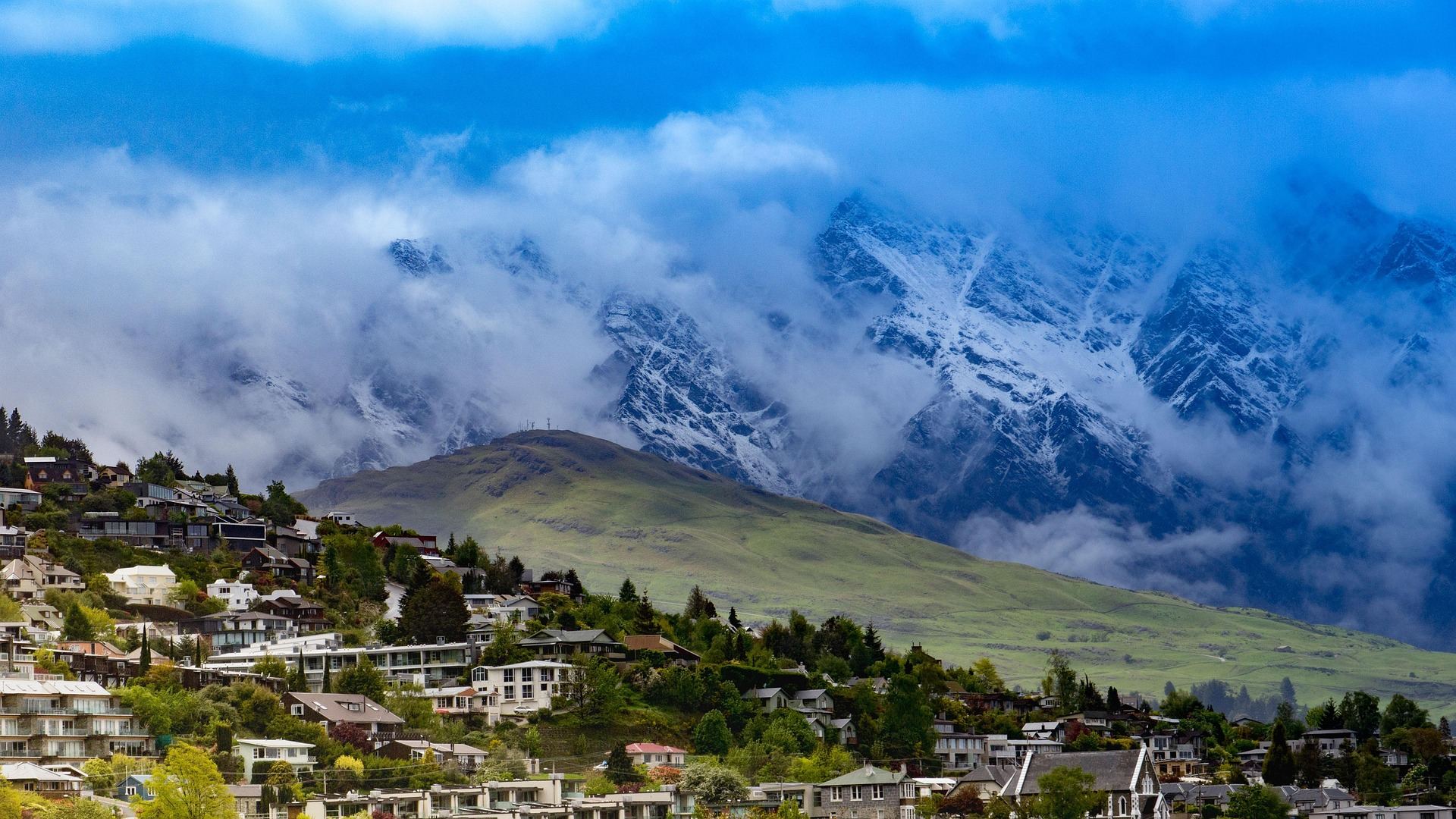
Houses climb a green hillside below cloud-wrapped snowy peaks. In New Zealand, high mountains often rise right behind town.
New Zealand is made up of two main islands, the North Island and the South Island. The Southern Alps run along the South Island, and the highest peak, Aoraki/Mount Cook, stands at about 3,724 m. Glacier-carved lakes, open grassland, coastal forest and volcanic landscapes all fit into one country.
It is also a country built for cycle touring. More than 20 long-distance trails known as the Great Rides (Ngā Haerenga) link old railway lines, rivers and lakeshores, with small towns and places to stay along the way, so they are easy to split over several days. Lots of gravel and some long climbs make them a good match for an e-MTB.
This guide centres on the signature Queenstown Skyline Traverse and covers five regions that work well for a first visit, with the roads and sights of each.
Queenstown, Otago · Lake Wakatipu at about 310 m
Queenstown Skyline Traverse
- Distance
- About 68 km
- Time
- Day trip (about 5 hours)
- Surface
- Lakeside cycle path plus gravel and dirt hill tracks
- Level
- Advanced
Queenstown is a small town on the shore of Lake Wakatipu, a lake about 80 km long. The Remarkables range, at about 2,300 m, rises across the water, and a gondola runs up Bob's Peak (about 790 m) behind town. People come here to ski in winter and to ride and hike in summer.
This route leaves town on a lakeside cycle path, then climbs onto gravel and dirt tracks above the lake and follows the ridges down with views of the water and the mountains. It is about 68 km with roughly 1,200 m of climbing in total, making it the most demanding of the five routes. There are several short, steep climbs, so managing the battery matters.
The Queenstown Trail, one of the Great Rides, covers about 130 km around the area. It links the lakeshore, the Kawarau River gorge, the old gold-mining town of Arrowtown and the vineyards of the Gibbston Valley, so on days when the ridge route feels like too much, you can ride this instead at an easy pace.
Things to see
Lake Wakatipu
A long, narrow lake carved by glaciers, with very clear water. The steamship TSS Earnslaw, in service since 1912, still crosses it.
Kawarau Gorge Suspension Bridge
A bridge built in 1880 and known as the birthplace of commercial bungy jumping. The trail passes close by, so stop for a look down into the gorge.
Arrowtown
A town founded in the 1860s gold rush. Its old main street and the settlement where Chinese miners lived have been restored, and the trees turn gold in autumn.
Bob's Peak lookout
Ride the gondola up for a view over Queenstown, the lake and the Remarkables. There is also a mountain bike park at the top, served by the gondola.
Central Otago · Middlemarch to Clyde, high point about 618 m
Otago Central Rail Trail
- Distance
- About 150 km
- Time
- 3–5 days
- Surface
- Compacted gravel rail trail
- Level
- Beginner
After the Central Otago railway closed in the early 1990s, its route was turned into a cycle trail that opened in 2000. It runs about 150 km from Middlemarch in the east to Clyde in the west, and it is often credited with making multi-day cycle touring popular in New Zealand.
Because trains once ran here, the gradients are very gentle, and with no cars it is easy going even for first-time e-MTB riders. Wide basins, brown hills and flocks of sheep line the trail, and a small town turns up several times a day.
Each town has an old hotel, a pub or a café, good for lunch or a night's stay. Most people ride 30–50 km a day, starting from either Clyde or Middlemarch.
Things to see
Poolburn Gorge tunnels and viaduct
Two old railway tunnels and a tall viaduct remain where the trail passes through a rocky gorge. The tunnels are unlit and dark inside.
Ophir
A small village with several 19th-century buildings. Its old post office and an old bridge with stone towers make it worth a short stop for photos.
The high point at Wedderburn
The highest point on the trail, marked by a sign at about 618 m. From here it is a gentle downhill whichever way you go.
Summer fruit
Central Otago's hot, dry summers are good for cherries and apricots. In midsummer you will easily find fruit stalls in the towns and along the roads.
Canterbury and Otago · Aoraki/Mount Cook to Oamaru
Alps 2 Ocean, from Snow Peaks to the Sea
- Distance
- About 300 km
- Time
- 4–6 days
- Surface
- Gravel trail plus some paved road
- Level
- Beginner to intermediate
New Zealand's longest Great Ride starts below the Southern Alps and runs about 300 km down to the east coast town of Oamaru. There are two starting points, Aoraki/Mount Cook Village and Lake Tekapo. The Mount Cook start includes a short helicopter hop across a river, so many riders begin at Tekapo instead.
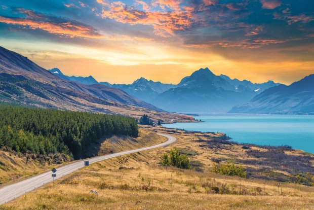
The first few days cross the wide grassland of the Mackenzie Basin between glacial lakes. Lake Pukaki gets its milky turquoise colour from fine rock flour ground by glaciers, and on a clear day Aoraki/Mount Cook appears at the far end of the lake. The trail then passes Lake Ohau and the hydro lakes of the Waitaki River, losing height as it goes.
On the last day you ride past limestone hills and farmland to reach the sea. The trail loses height overall from start to finish, so with a kind wind it can be easier than you expect.
Things to see
Lake Tekapo and the Church of the Good Shepherd
A small stone church built in 1935 sits on the lakeshore. The area is a protected dark sky reserve, so clear nights bring a sky full of stars.
Lake Pukaki
Turquoise water with the country's highest mountain behind it. The light is best early in the morning or toward evening.
Elephant Rocks
Big grey limestone boulders scattered across a field in the Waitaki Valley. A nice place to walk among the rocks and take a break.
Oamaru's old town
A harbour town lined with 19th-century buildings of white limestone. In the evening you can watch little blue penguins come ashore to their colony.
Bay of Plenty · Rotorua at about 280 m
Rotorua, Redwoods and Geothermal Land
- Distance
- 20–50 km per day
- Time
- 1–2 days
- Surface
- Forest dirt trails plus cycle paths
- Level
- Beginner to advanced (by trail)
Rotorua, in the middle of the North Island, is a town in geothermal country, where steam rises from the ground and mud bubbles. You can smell sulphur around town, and it is also well known as a place to see Māori culture up close.
Whakarewarewa Forest, right next to town, is one of the best-known mountain bike forests in the country. Californian redwoods planted in the early 1900s have grown tall, and a large network of trails, from easy to very hard, runs between them. New Zealand grades its mountain bike trails from 1 (easiest) to 6, which makes it easy to pick a trail that fits your skills.
If forest trails are not for you, try Te Ara Ahi, a Great Ride that runs from town south into geothermal country. It passes lakeshores and geothermal parks on the way to the colourful hot springs of Waiotapu.
Things to see
The Redwoods
Riding between huge, straight trunks is something special. There are plenty of easy trails near the forest entrance, so first-timers can start gently.
Te Puia and Pōhutu Geyser
A geyser that sends up a column of hot water several times a day. You can also see traditional Māori carving and crafts.
Kuirau Park
A geothermal park in the middle of town. Look at the boiling mud pools and rest your feet in the warm foot baths.
Hāngī
A traditional Māori meal of meat and vegetables steamed in an earth oven over hot stones. Many places serve it together with a cultural performance.
Auckland · Waitematā Harbour and the Hauraki Gulf
Auckland's Coast and Volcanic Hills
- Distance
- 30–55 km per day
- Time
- Day trip
- Surface
- Paved waterfront and cycle paths
- Level
- Beginner
Auckland, New Zealand's largest city, sits on a narrow strip of land between two harbours. Around 50 small volcanoes are scattered across the city, so as you ride along the coast you keep seeing round, grassy volcanic cones.
Tamaki Drive runs east from the city along the harbour, linking beach suburbs, with Rangitoto Island across the water. With little climbing, it is a good ride for your first day to get used to the bike. In the city you will also find Te Ara I Whiti, the Lightpath, a pink cycleway built on an old motorway off-ramp.
You cannot ride across the Auckland Harbour Bridge. To reach the North Shore, take your bike on the ferry to Devonport. A day trip by ferry to Waiheke Island, riding the hilly roads between vineyards and beaches, is also popular.
Things to see
Mission Bay
A beach halfway along Tamaki Drive. With lawns and cafés it is a good place for a break, and Rangitoto Island sits straight across the water.
Rangitoto Island
Auckland's youngest volcano, formed about 600 years ago. Its low, broad shape on the sea stands out from anywhere along the coast.
Maungawhau / Mount Eden
A volcanic hill in the middle of the city with a deep crater at the top. Leave the bike below and walk up for a view over the city and both harbours.
Devonport
An old seaside village a little over ten minutes away by ferry. Climb the small hill behind the village for a view of the city skyline and the harbour.
Good to know before you go
When to go
Seasons are the reverse of the Northern Hemisphere. November to March is the best time to ride. December to February is warmest but also busiest. In March and April the trees of Central Otago turn gold for autumn.
Weather
The weather often changes several times a day, so carry a windbreaker and a light rain jacket even when it is sunny. UV is very strong, so wear sunscreen and sunglasses even on cloudy days. The inland South Island is hot and dry in summer, and the mountains stay cool even then.
Roads and bikes
Most Great Rides are gravel, so a fat-tyred e-MTB is comfortable. Traffic drives on the left, and helmets are required by law when cycling. Towns can be far apart, so start every day with a fully charged battery.
Food
Lamb, green-lipped mussels, fish and chips and meat pies are the classics, and pavlova, a meringue cake, is the famous dessert. Coffee culture is strong and even small towns have a café. Central Otago is also known for its Pinot Noir.
Money and signal
The currency is the New Zealand dollar (NZD). Cards are accepted almost everywhere, even in small towns. Mobile signal is good in cities and along main roads, but drops out in the mountains and on remote trails.
Entry and safety
Entry rules vary by nationality and change over time, so check with the embassy before you go. Biosecurity is strict and officers check food and dirty shoes or gear carefully, so declare everything on your arrival card. When riding remote trails, tell your accommodation or companions your plans.
New Zealand's trails always end the day in a small town. Rest by a lake, have dinner at the pub, and ride out into new scenery the next morning. The weather changes often here, so leave a spare day in your plan.
Need a bike for these roads?
Pick your dates and we'll show the e-MTBs you can rent.