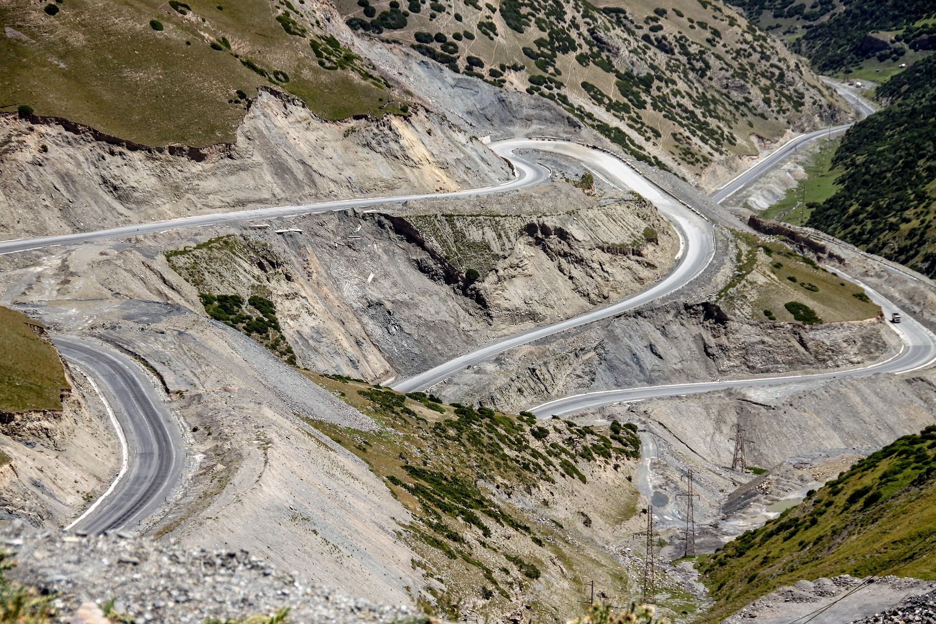
A switchback road over the Tian Shan. Most roads in Kyrgyzstan cross a mountain sooner or later.
Roughly 90% of Kyrgyzstan is mountains. The Tian Shan range runs across the country and the Pamir plateau rises in the south. Wide grasslands spread out even above 3,000 m, and every summer herders bring their animals up and set up yurts — round felt tents.
The real scenery here starts where the asphalt ends, which makes the country a natural fit for an e-MTB that helps you up long gravel climbs. Riding all day, sleeping in a yurt and waking up to the sun rising over a lake is an ordinary day here.
This guide centres on the signature Song-Kul ride and covers five regions that work well for a first visit, with the roads and sights of each.
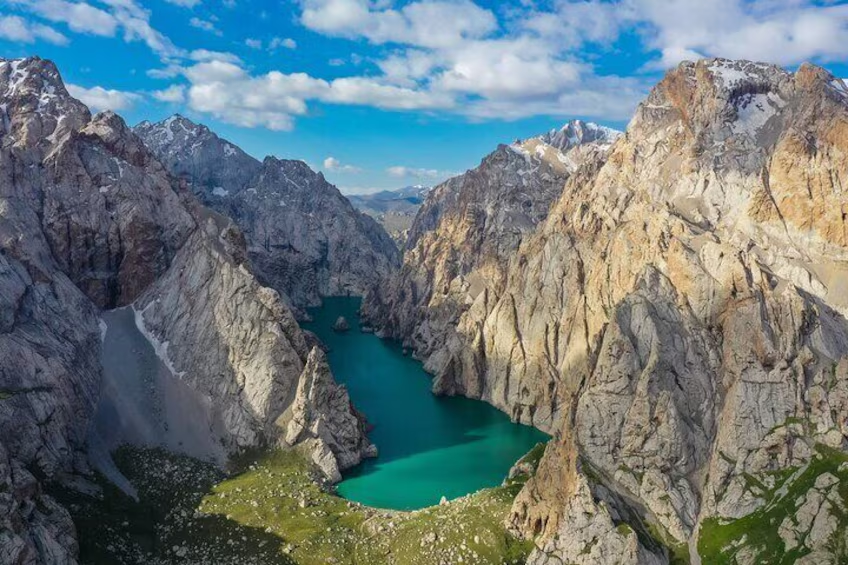
Naryn Region · lake at about 3,016 m
Song-Kul Sunrise Loop
- Distance
- About 80 km around the lake
- Time
- 2 days (1 night in a yurt)
- Surface
- Gravel and grassland tracks
- Level
- Intermediate
Song-Kul is a lake on a plateau above 3,000 m, surrounded by grassland as far as you can see. It is a summer pasture where herders stay only from June to September, so the yurt camps open only in those months. Ask people to name one landscape that sums up the country and many will say this one.
You reach the lake either from Kochkor in the north over the Kalmak-Ashuu pass (about 3,446 m), or from the south over the Moldo-Ashuu pass (about 3,346 m) with more than thirty switchbacks. On a regular bike that climb takes all day; on an e-MTB you can manage it comfortably if you pace the battery.
The lakeshore track has little climbing, so you can ride slowly and take in the view. Reach a yurt camp by sunset, have dinner, watch the Milky Way in a sky with no lights at all, and get up early to see the sun rise over the mountains across the water. That is where the route gets its name.
Things to see
Moldo-Ashuu switchbacks
Seen from above, the zigzag road looks like a drawing laid across the slope. Keep your speed down on the descent and stop often for photos.
Yurt camps
You sleep inside felt tents warmed by a stove. Dinner is usually mutton soup or noodles with fresh bread.
A morning on horseback
Most camps rent horses. Give the bike a rest and spend an hour or two crossing the grassland.
Kymyz
Fermented mare's milk, sour and slightly fizzy. It is an acquired taste, but it is how herders welcome guests, so try a sip.
Issyk-Kul Region · lake at about 1,607 m
Issyk-Kul South Shore
- Distance
- 40–70 km per day
- Time
- 2–4 days
- Surface
- Paved road plus canyon tracks
- Level
- Beginner to intermediate
Issyk-Kul is a huge mountain lake about 180 km long. It never freezes, which earned it the name 'warm lake', and snow-capped Tian Shan peaks surround it on every side. The north shore is full of resorts and gets busy; the south shore has only scattered villages and is much quieter to ride.
The main lakeside road is mostly paved, so it is easy even for first-time e-MTB riders. Turn toward the mountains for a few kilometres, though, and you find red canyons and waterfalls — heading up a dirt track once or twice a day is the fun of this route.
Karakol at the eastern end is the regional hub, with bike repairs and places to stay, and it makes a good base for day rides into the surrounding valleys.
Things to see
Skazka (Fairy Tale) Canyon
Red and yellow rock pillars carved by wind and rain. It is close to the lakeside road, and you can ride slowly along the dirt paths between the rocks.
Barskoon Valley and waterfalls
A valley running from the lake into the southern mountains. Follow it up to see waterfalls dropping off tall cliffs.
Jeti-Oguz red rocks
Red sandstone cliffs known as the 'Seven Bulls'. The split rock called 'Broken Heart' is nearby.
Karakol's wooden buildings
See the Dungan Mosque, built without nails, and a wooden Orthodox cathedral. On Sunday mornings the livestock market gives a close look at local life.
Chüy Region · Ala-Archa National Park, Burana Tower
Day Rides Around Bishkek
- Distance
- 30–60 km per day
- Time
- Day trip
- Surface
- Paved road plus park tracks
- Level
- Beginner
A good ride for your first or second day in the capital, to get used to the bike and the altitude. About 40 km south of the city, the valleys of Ala-Archa National Park begin, with juniper forest and glacier valleys below snowy peaks.
To the east stands the Burana Tower, a relic of the Silk Road era. Part of the tower, built around the 11th century, still stands, and stone figures (balbals) left by early nomads dot the field around it.
Both roads are in fairly good shape and you can be back in town for dinner, so this is a good day to check your gear and your legs before the high plateau.
Things to see
Ala-Archa Valley
The climb runs from the park entrance to the mountain hut deep in the valley. Ride alongside the river and a glacier comes into view straight ahead.
Burana Tower and balbals
Climb the narrow stairs inside the tower for a view across the Chüy Valley to the Tian Shan ridges.
Osh Bazaar
Bishkek's big market. Stock up on dried fruit, nuts and honey for snacks on the road.
At-Bashy, Naryn Region · about 3,200 m
Tash Rabat, a Stone Inn on the Silk Road
- Distance
- 50–70 km per day
- Time
- 1–2 days
- Surface
- Gravel valley road
- Level
- Intermediate
Tash Rabat is an old stone caravanserai tucked into a deep mountain valley. It is thought to date from around the 15th century, and merchants travelling between China and Central Asia stayed here. Dozens of small rooms connect like a maze under its domed roof.
The valley road from At-Bashy village sees few cars; flocks of sheep and the odd yurt appear along the way. The climb is long but gentle, which suits an e-MTB if you want to enjoy the view on the way up.
With spare time and energy you can spend a night in a nearby yurt and ride up the next day to Chatyr-Kul lake (about 3,500 m) near the Chinese border. It is a border zone that needs a separate permit, so check ahead.
Things to see
Inside the caravanserai
You explore the dark stone rooms by the light of tiny windows. A torch helps.
Valley yurts
In summer yurts go up along the valley, and many families offer tea and bread to passing travellers.
Chatyr-Kul lake
A lake in the middle of a treeless plateau, reflecting the sky like a mirror.
Osh Region · Pamir plateau, Sary-Tash at about 3,170 m
Alay Valley and Lenin Peak
- Distance
- 40–80 km per day
- Time
- 2–3 days
- Surface
- Paved pass road plus plateau tracks
- Level
- Advanced
This is the road into the Pamir at the southern edge of Kyrgyzstan. From the southern city of Osh you cross the Taldyk pass (about 3,615 m) and the broad Alay Valley opens up, with the huge snow peaks of the Pamir — Lenin Peak at 7,134 m among them — standing like a wall beyond it.
This is the 'Pamir panorama' in the country introduction. From Sary-Tash village, head toward Lenin Peak base camp to reach Tulpar-Kul lake, where you can spend a night in a yurt looking at the peaks reflected in the water.
The altitude is high and the weather changes fast, making this the hardest of the five routes. Go after you have acclimatised, and preferably with a guide.
Things to see
Taldyk pass
A winding paved pass road. Look back from the top to see the road you climbed wrapped around the mountainside.
Tulpar-Kul and Lenin Peak
Early in the morning, before the wind picks up, Lenin Peak is mirrored in the lake. Many travellers come just for this.
Sulaiman-Too in Osh
A rocky mountain in the middle of the city and a UNESCO World Heritage site. Climb it the day before you set off and look out over Osh.
Good to know before you go
When to go
June to September — the same months the yurt camps open on the high pastures. July and August are warmest. Snow can fall on the plateau from mid-September.
Altitude
Song-Kul, Tash Rabat and Alay are all above 3,000 m. Avoid big jumps in sleeping altitude, drink water often, and go down if a headache gets worse.
Roads and bikes
Main roads are paved, but most sights are at the end of gravel or dirt tracks. A fat-tyred e-MTB is a real advantage; on long climbing days, start in a low assist mode.
Food
Try beshbarmak (mutton and noodles), hand-pulled lagman noodles, plov and fried boorsok bread. Shops are rare on the plateau, so carry plenty of snacks.
Money and signal
The currency is the som (KGS). Cards work in cities, but villages and yurt camps are often cash only. Mobile signal is good in towns and along main roads, patchy on the plateau.
Entry and safety
Entry rules vary by nationality and change over time — check with the embassy before you go. Border areas may need a separate permit. Always wear a helmet and ride with at least one other person.
Kyrgyz roads are made for stopping, not rushing. Every hill brings a new view, and a herder on the road may well invite you in for tea. Leave a spare day in your plan and stay longer wherever you like it.
Need a bike for these roads?
Pick your dates and we'll show the e-MTBs you can rent.