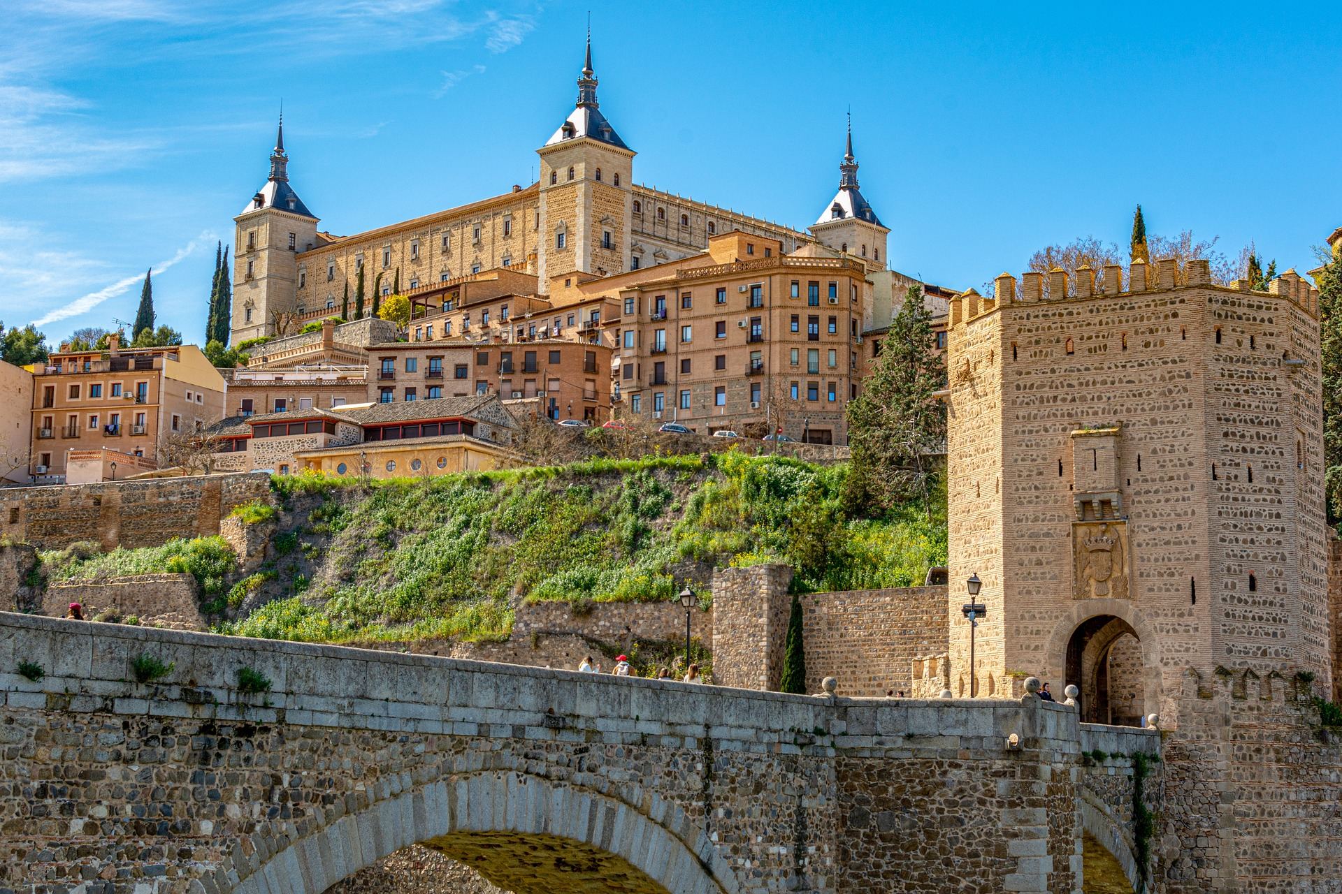
A fortress on the hill above an old stone bridge. Riding in Spain, you often pass old towns where walls and bridges still stand.
Spain covers most of the Iberian Peninsula. Mountain ranges surround the broad central plateau, the Meseta, where Madrid sits, and the Pyrenees form the border with France in the north. The northwest is rainy and very green, while the interior and the south are sunny and dry. The Atlantic, the Mediterranean and the Mediterranean islands bring very different landscapes into one country.
Spain also has a deep cycling culture. The Vuelta a España grand tour runs every year, and at weekends you meet club riders out on the mountain roads. There is plenty to choose from: pilgrim routes walked for more than a thousand years, the Vías Verdes cycle paths built on old railway lines, and winding island roads. On the long climbs, an e-MTB takes a lot of the strain off.
This guide centres on the signature Camino Coastal Loop and covers five regions that work well for a first visit, with the roads and sights of each.
Galicia · Santiago de Compostela at about 260 m
Camino Coastal Loop
- Distance
- About 60–70 km per day
- Time
- 1–3 days
- Surface
- Paved coast road plus Camino dirt paths
- Level
- Intermediate
Santiago de Compostela is where the Camino de Santiago ends. Since the Middle Ages, pilgrims from all over Europe have walked to its cathedral, said to hold the tomb of Saint James, and many now arrive by bike. The old town and the pilgrim routes are UNESCO World Heritage sites.
This loop heads west from Santiago to the Atlantic coast and its deep estuaries (rías), then follows the Camino back into the city. The coast side rolls up and down over small hills, while the inland side follows the footpaths pilgrims walk, between stone walls and woods.
With a few days to spare, continue to Cape Fisterra (Finisterre), the Camino's westward extension. About 90 km from Santiago, the cape was seen as the end of the world in Roman times, and many pilgrims still finish their journey here. So many ships were wrecked along this shore that it is called the Costa da Morte, the Coast of Death.
Things to see
Santiago Cathedral and Praza do Obradoiro
Pilgrims who have just finished the long walk sit on the square and gaze at the cathedral. Arriving by bike, you feel much the same.
Ponte Maceira
An old stone bridge over the Tambre River and a small village. It lies on the Camino to Fisterra, and pilgrims often stop here for a rest.
Cape Fisterra lighthouse
A lighthouse at the edge of the Atlantic with the Camino's 0 km marker stone. Crowds gather at dusk to watch the sun set into the sea.
Pulpo á feira
Galicia's signature dish: boiled octopus sliced and dressed with olive oil, paprika and salt. It goes well with the local white wine, Albariño.
French Basque Country to Navarre · Ibañeta pass about 1,057 m
The First Pass over the Pyrenees: Saint-Jean to Roncesvalles
- Distance
- About 60 km return
- Time
- Day trip
- Surface
- Paved pass road
- Level
- Advanced
Saint-Jean-Pied-de-Port is a small walled town on the north side of the Pyrenees, in the French Basque Country. The Camino Francés, the busiest of the pilgrim routes, usually starts here, and on day one it crosses the Pyrenees and drops down to Roncesvalles in Navarre, Spain.
There are two ways over. The high Route Napoléon is steep and busy with walkers, and it can be closed in winter when conditions are dangerous. By bike, take the lower road through the village of Valcarlos and over the Ibañeta pass. From Saint-Jean at about 170 m, it is a long climb of nearly 900 m to the pass, where the e-MTB's help really counts.
Riding to Roncesvalles and back the same way is about 60 km. With another day, continue from Roncesvalles through forests and villages down to Pamplona, the main city of Navarre.
Things to see
Saint-Jean's walled town
Cobbled lanes run inside the town walls, and an old bridge over the Nive River is at the heart of the scene. It is also where pilgrims collect their first stamp.
Ibañeta pass
A small chapel and a monument to Roland stand at the top. The ambush of Charlemagne's rearguard in this area in 778 lives on in the medieval epic, The Song of Roland.
Roncesvalles
An old monastery and church in the forest below the pass. It has welcomed pilgrims crossing the Pyrenees since the Middle Ages.
Pintxos in Pamplona
Small bites served on bread, picked bar by bar. Pamplona is also famous for the San Fermín festival in July.
Castilla-La Mancha · Toledo at about 530 m
Toledo and the Windmill Hills of La Mancha
- Distance
- 30–70 km per day
- Time
- 1–2 days
- Surface
- Paved road plus riverside dirt paths
- Level
- Beginner to intermediate
Toledo is an old hilltop city about 70 km south of Madrid. The Tagus River wraps around three sides of it, and the Alcázar fortress and the cathedral crown the hill. It is known as a city where Christian, Muslim and Jewish heritage lives side by side, and the whole old town is a UNESCO World Heritage site.
The best ride circles the city on the hills across the river, with several viewpoints where walls and towers stack up beyond the gorge. The lanes inside the old town, though, are narrow, steep and cobbled, so it is better to get off and walk the bike there.
South of Toledo lie the plains of La Mancha, the setting of Cervantes' Don Quixote. In villages such as Consuegra, white windmills line the ridge above town. The plain is flat, but strong headwinds are common, and that is when an e-MTB really helps.
Things to see
Alcántara and San Martín bridges
Two old stone bridges that cross the Tagus into the old town. The view of the gorge and the walls from the bridges is excellent.
Toledo Cathedral
A large Gothic cathedral begun in the 13th century. Works by the painter El Greco hang inside.
Consuegra windmills
White windmills stand in a row on the hill beside an old castle. The road up is short but steep, so take it slowly.
Marzipan and Manchego
Marzipan, made from almonds and sugar, is Toledo's classic sweet. Be sure to try Manchego, the sheep's milk cheese of La Mancha, too.
Cádiz and Málaga provinces, Andalusia · Ronda at about 740 m
Andalusia's Old Railway and the Ronda Gorge
- Distance
- About 36 km of rail trail plus Ronda
- Time
- 1–2 days
- Surface
- Compacted rail trail plus paved mountain roads
- Level
- Beginner to intermediate
All over Spain, disused railway lines have been turned into cycle and walking paths called Vías Verdes (green ways). The Vía Verde de la Sierra runs about 36 km between Olvera and Puerto Serrano through hills and valleys, with one tunnel and tall viaduct after another. The gradients are gentle, so anyone can ride it comfortably.
This area is famous for its pueblos blancos, white villages clustered on hillsides. From Olvera, mountain roads lead south past Setenil de las Bodegas, where houses are built under the rock, to Ronda.
Ronda straddles El Tajo, a gorge about 100 m deep. The Puente Nuevo, built across the gorge in the 18th century, links the two halves of the city, and the view of the cliffs from the lookouts around the bridge is the defining image of the region.
Things to see
Vultures of Peñón de Zaframagón
A rock tower rising beside the rail trail, protected as a nature reserve with a large colony of griffon vultures. Watch them circling overhead.
Olvera
A village with an old castle and church on the hilltop and white houses spread below. It sits at one end of the rail trail, so explore it before or after your ride.
Setenil de las Bodegas
A village where homes and shops are dug in under huge riverside rocks. Walking the lanes beneath a roof of stone is unlike anywhere else.
Ronda's Puente Nuevo
A stone bridge rising high from the floor of the gorge. Cross it first, then take the path down into the gorge and look up to feel its full size.
Balearic Islands · Coll dels Reis about 682 m
Mallorca's Serra de Tramuntana
- Distance
- 50–100 km per day
- Time
- 3–5 days
- Surface
- Paved mountain roads
- Level
- Intermediate to advanced
Mallorca is a Spanish island in the western Mediterranean. The Serra de Tramuntana runs along its northwest coast, and its mix of terraced olive groves and stone villages is a UNESCO World Heritage cultural landscape. Mild winters bring riders here in spring, autumn and winter, and the island is known as a training base for professional teams.
The most famous road is the descent to Sa Calobra. Built in the 1930s, it twists all the way down to a small cove, and partway down there is the 'tie knot', where the road loops under itself. It is a dead end, so you have to climb about 10 km back the way you came, and planning your battery matters.
On the island's northern tip, the Cap de Formentor road follows the clifftops out to a lighthouse. Link the mountain villages of Valldemossa, Deià and Sóller and you get a day that switches between mountain and sea views.
Things to see
The Sa Calobra switchbacks
The road snakes down between grey rocks. At the cove, leave the bike and walk to the mouth of the Torrent de Pareis gorge.
Cap de Formentor
A narrow peninsula reaching out from the island's northern tip. From the lookout partway along, you can look down cliffs that drop straight into the sea.
Valldemossa
A stone village in the mountains, with the old monastery where the composer Chopin spent a winter. Flower pots hang along its narrow lanes.
Sóller's orange valley
Orange groves fill a valley ringed by mountains. An old wooden train still runs between Palma and Sóller.
Good to know before you go
When to go
March to June and September to November are best. In July and August the interior and the south are very hot, and the coast and islands are crowded with holidaymakers. Mallorca and the southern coast stay fairly mild in winter, so riding there is possible year-round.
Weather
The weather varies a lot by region. Galicia and the north are rainy and cool, while the Meseta and inland Andalusia are hot and dry in summer. In mountains such as the Pyrenees, the passes are chilly even in summer, so bring a jacket.
Roads and bikes
Paved roads are in good shape, and with so many cyclists, drivers are fairly used to bikes. The Camino and the Vías Verdes have dirt and gravel sections where a fat-tyred e-MTB is comfortable. Always wear a helmet, and start in a low assist mode on days with long climbs.
Food
Tapas, jamón (cured ham), tortilla (potato omelette), gazpacho (cold tomato soup) and Valencian paella are the classics. Lunch is often around 2 pm and dinner after 9 pm, so restaurant hours may be later than you are used to.
Money and signal
The currency is the euro (EUR). Most shops and restaurants take cards. Mobile signal is good in towns and along main roads, with some gaps in mountain valleys.
Entry and safety
Entry rules vary by nationality and change over time, so check with the embassy before you go. Watch out for pickpockets at big-city sights and train stations, and always lock your bike when you leave it. In midsummer, ride early in the morning to avoid the heat.
Spain's roads run through very old stories. You greet pilgrims, rest below castle walls and finish the day with a late dinner. Do not rush in the heat; like the locals, take a break in the middle of the day.
Need a bike for these roads?
Pick your dates and we'll show the e-MTBs you can rent.