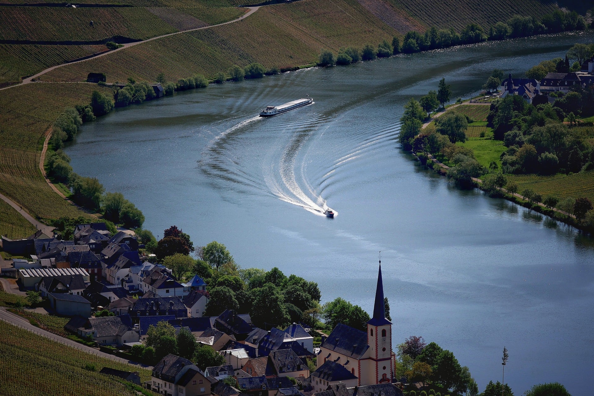
A river curving between vineyard slopes, with a small village on its bank. Germany's riverside cycle paths follow scenery like this.
About a third of Germany is forest. The north is flat, the middle is a patchwork of low hills and river valleys, and only at the southern edge, in Bavaria, do the Alps rise up. Almost every big river has a cycle path running beside it, and the signposting is good.
Forest tracks and rolling hills make Germany a good fit for an e-MTB. With the motor helping on the climbs you can link forest, lakes and several villages in a single day, and on a tired day you can put the bike on a train back to your hotel.
This guide centres on the signature Bavarian Forest circuit and covers five regions, from the road south of Munich toward the Alps to the Moselle valley, with the roads and sights of each.
Lower Bavaria · about 600–1,400 m
Bavarian Forest Circuit
- Distance
- About 66 km loop
- Time
- Day trip
- Surface
- Forest tracks plus paved lanes
- Level
- Intermediate
The Bavarian Forest is a range of low mountains in south-east Germany, on the Czech border. Germany's first national park was created here in 1970, and together with the Šumava National Park across the border it is counted as the largest protected forest area in Central Europe. Rounded summits of around 1,400 m rise above spruce and beech woods.
The circuit alternates between forest tracks and the small paved lanes that link the villages. Instead of one long climb you get many short rises, so on an e-MTB you can spread your effort evenly. Inside the national park you may ride only on routes signed for bikes; narrow hiking paths and the summit trails are for walking.
The park follows a simple rule: let nature be nature. Spruce killed by bark beetles is left standing, and young trees now grow up between the grey trunks. Watching the same forest change a little each year is part of the appeal of this ride.
Things to see
Treetop walkway
At the national park centre near Neuschönau, a long wooden walkway runs at treetop height and ends in an egg-shaped tower. Leave the bike below and walk up for a view across the forest to the hills on the Czech side.
Animal enclosures
Around the park centre, a forest trail passes large enclosures with local animals such as lynx, wolves and brown bears. Early morning and evening are the best times to see them.
Großer Arber and its lake
At about 1,456 m, the highest mountain in the Bavarian Forest. A small glacial lake ringed by forest sits at its foot and makes a good place for a break.
Glassmaking villages
Glass has been made in this region for centuries. In towns like Zwiesel you will find glass workshops and shops everywhere.
Upper Bavaria · Munich at about 520 m → Bad Tölz at about 660 m
Munich to the Alpine Gateway along the Isar
- Distance
- About 60 km one way
- Time
- Day trip (train back)
- Surface
- Paved plus packed gravel
- Level
- Beginner to intermediate
The Isar flows down from the Alps and straight through the middle of Munich. Its water is a clear green-blue, and wide gravel banks remain even in the city, where people come to relax in summer. Ride upstream to the south and in one day you watch the city turn into forest and the forest turn into the foothills of the Alps.
South of Munich the river cuts between steep banks and the path enters the woods. Most of it is paved or well-packed gravel, but there are a few short, steep climbs from the river up to the villages on the bluffs. This is where an e-MTB really helps.
After Wolfratshausen the valley opens out, and on a clear day the first Alpine ridges appear close to the south. The finish, Bad Tölz, is an old spa town on the Isar, and from there you can take the train back to Munich.
Things to see
Englischer Garten
A huge park in the middle of Munich. You can ride on its paths, and the beer garden at the Chinese Tower is a good place to stop.
Isar gravel banks
South of the centre the river spreads over wide gravel beds. Sit by the clear water and stretch before you set off.
Schäftlarn Abbey
A Benedictine abbey first founded in the 8th century, set in the wooded river valley. Many riders stop for lunch at the inn beside it.
Bad Tölz market street
The main street climbs a hill between old houses with painted façades. Push the bike and walk up slowly.
Berchtesgaden, Upper Bavaria · about 600–1,500 m
Berchtesgaden and the Königssee
- Distance
- 30–60 km per day
- Time
- 1–2 days
- Surface
- Paved roads plus valley gravel
- Level
- Intermediate
This Alpine corner sits at the far south-east of Germany, right next to Salzburg in Austria. Berchtesgaden National Park, founded in 1978, is Germany's only Alpine national park, and the Watzmann (about 2,713 m) rises in its centre.
It is also the last stage of a long-distance cycle route of more than 400 km that crosses southern Germany from Lake Constance. The roads between villages and lakes mix pavement and valley gravel, and the climbs are short but steep, which suits an e-MTB.
Inside the national park, bikes are allowed only on certain roads. Ride where you see bike signs and explore the other mountain paths on foot. If you have energy to spare, try the Rossfeld panoramic road, which climbs to over 1,500 m.
Things to see
Königssee
A long, clear lake between steep rock walls. Only electric boats have run here for more than a hundred years, so it is quiet, and the boatman sometimes plays a trumpet to show off the echo.
St. Bartholomä
A small church with red onion domes on the lakeshore, reachable only by boat or on foot. Leave the bike near the boat landing.
Ramsau
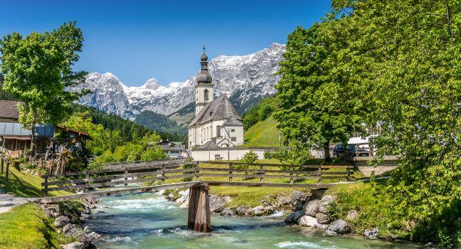
A village where a bridge over a mountain stream, a white church and the rock peaks behind come together. Ride gently up the valley to the small Hintersee lake nearby.
Salt mine
Salt has been mined in Berchtesgaden for more than 500 years. On the mine tour you wear miners' clothes and ride down wooden slides.
Allgäu, Swabia · Füssen at about 800 m
Füssen, the Royal Castles and the Allgäu Lakes
- Distance
- 30–50 km per day
- Time
- 1–2 days
- Surface
- Paved cycle paths plus packed gravel
- Level
- Beginner
Füssen is a small town at the foot of the Alps where Germany's well-known Romantic Road ends. Lakes large and small surround it, and on the mountainside stands Neuschwanstein, the castle built by King Ludwig II of Bavaria.
The most popular ride is the cycle path around the Forggensee, the big reservoir north of Füssen. Much of it is flat, with the Alps and the castle in view across the water. The lake is drained in winter and refilled in summer, so come between June and autumn to see it full.
The road up to the castle is crowded, so it is best to leave the bike in the village of Hohenschwangau below and walk up. With an extra day, ride out to the Wieskirche, a church standing alone in the fields to the north.
Things to see
Neuschwanstein
Building began in 1869, but the king died before it was finished. The view of the castle from the bridge on the mountain above is the most famous.
Hohenschwangau and the Alpsee
The yellow castle where Ludwig II spent his childhood, and the clear lake below it surrounded by mountains. A walk along the shore makes a good rest.
Wieskirche
A small pilgrimage church in the middle of a meadow, listed as a UNESCO World Heritage site for its rich Rococo interior. You can reach it from Füssen on country lanes.
Lech Falls
Right next to Füssen town centre, the Lech drops over a series of steps. The turquoise water makes it a nice stop at the start or end of the day.
Rhineland-Palatinate · Trier to Koblenz, river at about 60–130 m
Moselle Vineyard Path
- Distance
- 40–60 km per day (about 200 km in all)
- Time
- 1–5 days
- Surface
- Paved riverside cycle path
- Level
- Beginner
The Moselle flows in from France, crosses western Germany and joins the Rhine at Koblenz. At every big bend, vineyards climb the steep slopes, and small wine villages gather around their church spires along the bank. The region is best known for Riesling.
A cycle path follows the river for about 200 km from Trier to Koblenz. Riding downstream it is almost flat, and nearly all of it is paved, so beginners can split it over several days. If you only have one day, pick the stretch around Bernkastel-Kues or Cochem.
The riverside path is easy, but the lanes up to the viewpoints above the vineyards are very steep. These short climbs are where an e-MTB shines. From the top you can see the river sweep in a wide bend around the villages.
Things to see
Porta Nigra in Trier
Trier was founded in Roman times and is often called Germany's oldest city. The Porta Nigra, a blackened Roman city gate, is a UNESCO World Heritage site.
Bernkastel-Kues
A wine village with old half-timbered houses around a small square. The view of the village from the bridge across the river is also lovely.
Cochem Castle
A castle on a hill above the river, destroyed in the 17th century and rebuilt in the 19th. The riverside town below is a good place for a break.
Calmont vineyard at Bremm
One of the steepest vineyards in Europe. The paths on the slope are for walking only, so look up from the riverbank or leave the bike and climb on foot.
Good to know before you go
When to go
May to October. June to August is warmest with the longest days; in September and October the forests change colour and the grape harvest begins. During Munich's Oktoberfest, from late September to early October, rooms in Munich are expensive and hard to find.
Weather
Summer daytime temperatures are usually in the mid-20s °C, but rain can come in any season. The Bavarian Forest and the Alps are cooler than the cities, and thunderstorms are common on summer afternoons in the mountains. Always carry a light rain jacket.
Roads and bikes
Well-signed cycle paths follow many rivers and lakes. The rules on riding forest paths differ from state to state, so stick to signed cycle and mountain bike routes and give way to walkers. A standard e-MTB whose motor assists only up to 25 km/h counts as a bicycle.
Food
In Bavaria, try white sausage with pretzels, roast pork knuckle and obatzda cheese spread; in the Allgäu, käsespätzle (cheese noodles). Most shops close on Sundays and public holidays, so buy snacks the day before.
Money and signal
The currency is the euro (EUR). Card payment is now common, but some small restaurants and village shops take cash only. Mobile signal is good in towns and along main roads, with gaps in forests and mountain valleys.
Entry and safety
Germany is in the Schengen Area. Entry rules vary by nationality and change over time, so check with the embassy before you go. Traffic drives on the right. Wear a helmet even though the law does not require one.
German roads are good at stringing several landscapes into one day. Ride through forest in the morning, have lunch in a riverside village and finish the day in a beer garden with a view of the Alps. Take your time, and stay an extra night wherever you like it.
Need a bike for these roads?
Pick your dates and we'll show the e-MTBs you can rent.