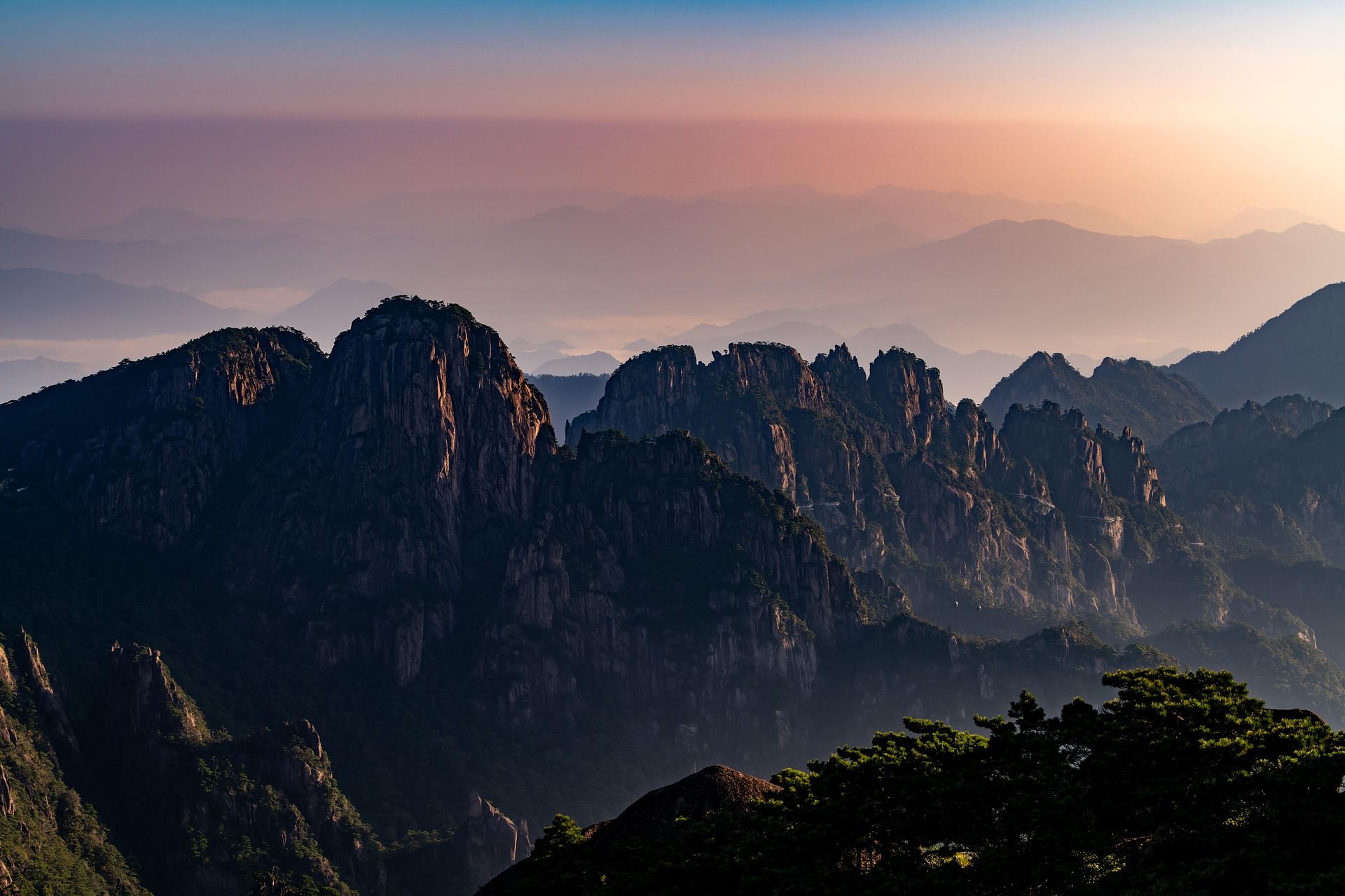
Rock peaks rising above a thin morning haze at first light, with pines growing on the ridge in front.
A country this big offers every kind of riding. In the west are the Tibetan and Pamir plateaus, where the average altitude is above 4,000 m. In Yunnan to the southwest, old villages sit below snow peaks, and in the north the Taihang Mountains line up in red cliffs.
Plateau roads are high and long, so a regular bike does not get far in a day. An e-MTB helps you up the climbs, which leaves you enough breath to enjoy the view even at altitude.
This guide centres on the signature Lhasa Sky Loop and covers five regions, Tibet, Yunnan, the Taihang Mountains and the Pamir, with the roads and sights of each.
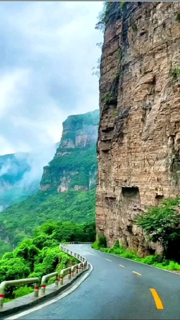
Lhasa, Xizang (Tibet) Autonomous Region · about 3,650 m
Lhasa Sky Loop
- Distance
- 30–50 km per day
- Time
- 2–3 days (around Lhasa)
- Surface
- Paved road plus climbs to monasteries
- Level
- Intermediate (acclimatisation needed)
Lhasa, the main city of Tibet, lies in a wide river valley at about 3,650 m. The Lhasa River runs along the south of the city, and a deep blue sky stretches over the brown mountains around it. The air is clear and the sun is strong, so on a fine day the sky feels very close. That is where the route gets its name.
The loop starts near the Potala Palace and the Jokhang in the centre, follows the Lhasa River along its banks, and visits Drepung and Sera monasteries on the hillsides to the west and north of the city. The city itself is nearly flat, but the last stretch to each monastery climbs the slope, and that is where the e-MTB earns its keep.
For your first day or two in Lhasa, leave the bike and explore on foot while your body adjusts to the altitude. Once you are less out of breath, start with short rides and add a little distance each day.
Things to see
Potala Palace
A palace of white and red buildings rising in tiers up a hill, once home to the Dalai Lama. Together with the Jokhang and Norbulingka it is a UNESCO World Heritage site. From the square opposite you can take in the whole palace at once.
Jokhang and Barkhor
The Jokhang is believed to date back to the 7th century and is one of the most important places for Tibetans. On the Barkhor, the street that circles it, pilgrims walk clockwise in prayer. Park the bike here and join the flow of pilgrims on foot.
Drepung Monastery
Founded in the early 15th century, Drepung was once home to thousands of monks. Its white buildings cluster on the hillside like a village, with views down over Lhasa and the river valley.
Debates at Sera
Sera is known for its debating monks, who gather in a courtyard and question each other on Buddhist teaching with loud claps. Ask your local guide whether you can see a debate on the day you visit.
Southwest of Lhasa · pass about 4,800 m, lake about 4,400 m
Kamba La and Yamdrok Lake
- Distance
- About 100 km from Lhasa to the pass
- Time
- 1–2 days
- Surface
- Paved pass road plus lakeside road
- Level
- Advanced
Yamdrok is one of the large lakes Tibetans hold sacred. It sits at about 4,400 m, and its colour shifts from turquoise to deep blue with the weather and light. The lake reaches into the mountains in many arms, so from above its shape looks intricate.
From Lhasa you follow the river southwest, cross the Yarlung Tsangpo and climb a winding road to the Kamba La pass (about 4,800 m). The moment the lake opens up below you at the top is the highlight of the route. The climb gains more than 1,000 m, so many itineraries cover part of it by support vehicle and ride the descent and the lakeshore.
The road along the shore has fairly little climbing and passes barley fields, small villages and herds of yak. At this altitude even walking leaves you breathless, so plan this ride after several days of acclimatising in Lhasa.
Things to see
Prayer flags at Kamba La
Five-coloured flags printed with prayers flutter at the top of the pass. On a clear day you can see snowy ridges beyond the lake.
Yarlung Tsangpo
A great river crossing southern Tibet from west to east, which becomes the Brahmaputra further downstream in India. The flat stretch along its wide valley is a good warm-up.
Lakeside villages
Small villages of earth-walled houses with flags on the roofs. Stop for butter tea and tsampa (roasted barley flour).
Dali, Shaxi and Lijiang, Yunnan · about 2,000–2,400 m
Tea Horse Road, Dali to Lijiang
- Distance
- 40–70 km per day
- Time
- 3–5 days
- Surface
- Paved road plus old stone paths
- Level
- Intermediate
The Tea Horse Road was an old trade route where tea from Yunnan and Sichuan was exchanged for Tibetan horses. Caravans of horses and mules carried loads over high mountains, and in northwest Yunnan the old villages and markets that grew up along the way still stand.
Dali, between Erhai Lake and the Cang Mountains, is a good place to start. Ride the lakeside road through Bai villages, then cross the hills north to Shaxi. Shaxi was a market town on the Tea Horse Road, and its old market square, stage and stone bridge are well preserved.
The ride ends in Lijiang at about 2,400 m. Its old town is a UNESCO World Heritage site, with streams running between the lanes and rows of tiled Naxi houses. On a clear day the snowy summit of Jade Dragon Snow Mountain shows to the north.
Things to see
Erhai lakeshore
Dali's big lake takes more than 100 km to ride around. The lakeside village of Xizhou has many traditional Bai houses with painted white walls.
Sideng market square, Shaxi
A stone-paved square framed by an old stage, a temple and old shopfronts. It keeps the feel of a market town where traders and horses once rested.
Lijiang Old Town
The lanes are narrow and crowded, so leave the bike at your guesthouse and walk. In the evening lanterns light up under the eaves.
Baisha village
A quiet old village north of Lijiang. It is close to town for a short ride, and Jade Dragon Snow Mountain looks near from here.
Northern Henan · Taihang Mountains around Xinxiang and Linzhou
Taihang Cliff Roads
- Distance
- 45–70 km per day
- Time
- 1–3 days
- Surface
- Paved mountain roads
- Level
- Beginner to advanced (by section)
The Taihang Mountains run north to south along the borders of Henan, Shanxi and Hebei in northern China. Reddish rock forms cliffs hundreds of metres high, cut through by deep canyons.
The region is known for roads carved into the cliffs. Rock wall on one side and open valley on the other means the view never stops. Most roads are paved and good for riding, but short steep climbs and fast descents come one after another.
Xinxiang and Linzhou in northern Henan make good bases. Cliff villages and canyon scenic areas are close together, so you can choose anything from a short day ride to a long ridge crossing to suit your legs.
Things to see
Guoliang village and its cliff tunnel
A small village on top of a cliff, where villagers cut a tunnel road through the rock by hand in the 1970s. Openings in the tunnel wall look down into the valley.
Red Flag Canal
An irrigation channel cut along the cliffs by the people of Linzhou in the 1960s. Walk beside the canal on the mountainside to see the scale of the work.
Taihang Grand Canyon
A large canyon in Linzhou with red cliffs and waterfalls. The views from the road along the top are excellent.
Kashgar and Tashkurgan, Xinjiang · Karakul Lake about 3,600 m
The Pamir and the Karakoram Highway
- Distance
- 40–80 km per day
- Time
- 2–4 days
- Surface
- Paved road plus plateau gravel
- Level
- Intermediate to advanced
The Karakoram Highway starts south of Kashgar, in Xinjiang at China's far western edge. On its way to Pakistan it crosses the Pamir plateau, with snow peaks over 7,000 m lining both sides.
Leave Kashgar and climb through a gorge to reach Karakul Lake, overlooked by Muztagh Ata (about 7,546 m) and Kongur (about 7,649 m). Kyrgyz herders set up yurts on the grassland by the shore, and on still mornings the peaks are mirrored in the water.
Further south is Tashkurgan (about 3,100 m), home to Tajik communities. The stretch along its wide grassy valley has gentle gradients and is a pleasure to ride. This area is close to the border, with permits and checkpoints, so plan your route with a local travel agency.
Things to see
Karakul Lake
A lake on the plateau below the snow peaks. It is at its best at sunset and early morning, and you can ride slowly along the shore.
Muztagh Ata
A rounded snow peak whose name means 'father of ice mountains'. It looks close from the road, which makes its size easy to feel.
Tashkurgan Stone City
The ruins of an old stone fortress. From the walls you see the grassland below and snow peaks in the distance.
Kashgar's markets
An old market city worth a visit before or after the ride. Try lamb skewers, naan from the clay oven and dried fruit.
Good to know before you go
When to go
May to October for Tibet and the Pamir. July and August bring more rain, though in Lhasa it often falls at night. Spring (April–May) and autumn (September–October) are best for Yunnan and the Taihang Mountains. Avoid the National Day holiday in early October, when everywhere is crowded.
Altitude and weather
Lhasa is at about 3,650 m, and Yamdrok Lake and the Pamir are higher still. Raise your sleeping altitude slowly, drink water often, and go down straight away if a headache or dizziness gets worse. On the plateau it can be warm in the day and very cold after sunset.
Roads and bikes
Main roads are mostly well paved, but there are many trucks and some long tunnels. Bring lights and bright clothing. Traffic drives on the right. Most e-MTB batteries cannot go on a plane, so renting the bike and battery locally is the usual choice.
Food
In Tibet try tsampa, butter tea, yak meat and momo dumplings; in Yunnan, crossing-the-bridge rice noodles and Pu'er tea; in Xinjiang, lamb skewers, polo (pilaf) and oven-baked naan. Shops are far apart on the plateau, so carry plenty of snacks.
Money and signal
The currency is the yuan (CNY, renminbi). Most shops and restaurants use mobile payment, so set up a payment app before you go and carry some cash too. Some foreign apps and websites do not work, so sort out maps and messaging in advance. Signal drops out in places on the plateau and in canyons.
Entry and safety
Entry rules vary by nationality and change over time, so check with the embassy before you go. Tibet requires a separate permit and a guide for foreigners, and border areas of Xinjiang may also need permits. Hotels register guests by passport, so keep it with you. Always wear a helmet.
China is too big to see in one trip. Choose Tibet and the Pamir for plateau skies, Yunnan for old villages and tea culture, or the Taihang Mountains for cliff roads on a short schedule. Wherever you go, leave a spare day in your plan so you can linger over the views.
Need a bike for these roads?
Pick your dates and we'll show the e-MTBs you can rent.