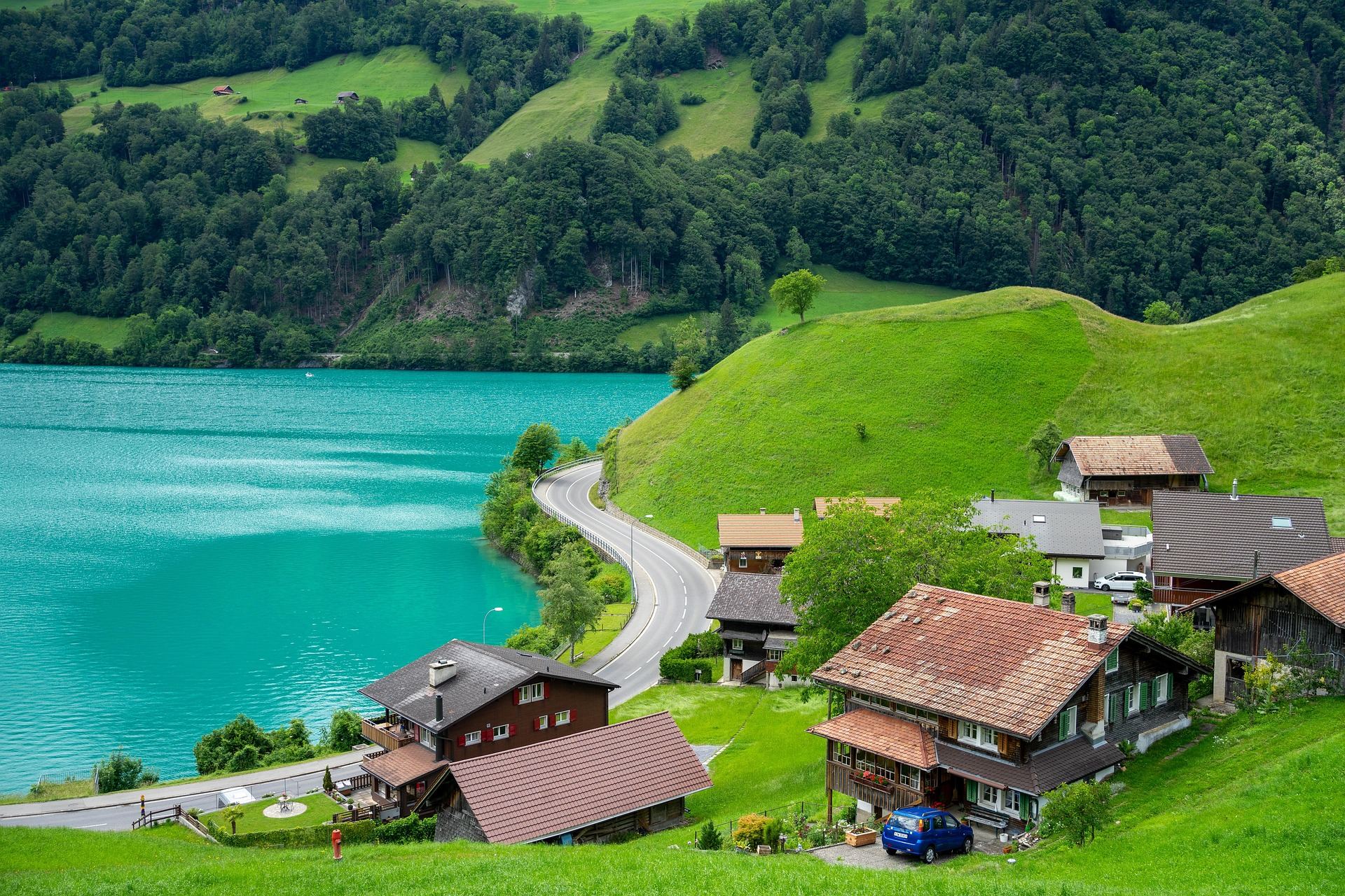
A road curving along a turquoise lake, with wooden houses on the green hillside. Many Swiss pass roads start beside a lake like this.
About 60% of Switzerland is Alps. Clear lakes and deep valleys lie below peaks over 4,000 m and their glaciers, and old pass roads climb between them. The country has four national languages (German, French, Italian and Romansh), so crossing a single pass can change both the language and the food.
A dense network of numbered cycle and mountain bike routes covers the whole country, and you can take your bike on trains, boats and postbuses. With an e-MTB to help on the long climbs, it is easy to plan days where you ride over one pass and take the train back.
This guide centres on the signature Interlaken high pass ride and covers five regions that work well for a first visit. The pass roads are mostly paved, and we have chosen only mountain paths where bikes are allowed.
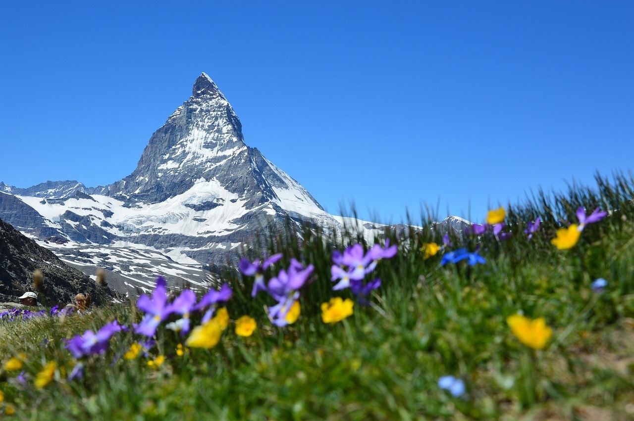
Canton of Bern · Interlaken about 570 m → Grosse Scheidegg about 1,962 m
Interlaken High Pass Ride: Grosse Scheidegg
- Distance
- About 50 km, Interlaken to Meiringen
- Time
- Day trip
- Surface
- Narrow paved pass road
- Level
- Advanced
Interlaken sits between Lake Thun and Lake Brienz and is the starting point for the Jungfrau region. This ride climbs from Interlaken to Grindelwald, crosses the Grosse Scheidegg pass at about 1,962 m and drops down the other side to Meiringen. With about 1,400 m of climbing, it is the hardest day of the five.
Beyond Grindelwald the road narrows, and from there over Grosse Scheidegg to Schwarzwaldalp private cars are not allowed; only postbuses and bikes use it. You climb with no traffic noise, right beside the huge rock walls of the Eiger north face and the Wetterhorn, which is why Swiss cyclists love this road.
Over the top, a steep descent winds through forest and pasture past Rosenlaui to Meiringen. If you still have energy, ride back along Lake Brienz to Interlaken to close a loop of about 80 km; if not, take the train from Meiringen.
Things to see
Eiger north face
From the Grindelwald side, the north face of the Eiger (about 3,967 m) rises like a wall across the sky. Stop often on the climb and look back.
Grosse Scheidegg pass
At the top the Wetterhorn towers right above you, and the Grindelwald valley you climbed lies spread out below. The inn on the pass is a good place for a break.
Reichenbach Falls
A big waterfall near Meiringen, where Sherlock Holmes fights Professor Moriarty in the stories. A small funicular takes you up close to the falls.
Lake Brienz
A lake fed by glacier meltwater that glows turquoise. The lakeside village of Brienz is known for its woodcarving.
Canton of Bern · Lauterbrunnen at about 800 m
Lauterbrunnen Waterfall Valley
- Distance
- About 40–55 km round trip from Interlaken
- Time
- Day trip
- Surface
- Paved road plus short gravel stretches
- Level
- Beginner
Lauterbrunnen is a U-shaped valley between sheer rock walls hundreds of metres high. Glaciers carved it, so the floor is flat, and dozens of waterfalls pour off the cliffs on both sides. That is why it is nicknamed the valley of 72 waterfalls.
From Interlaken the road climbs gently along the river to the valley entrance, and from Lauterbrunnen village to Stechelberg at the head of the valley it is almost flat. With little climbing, it is a good first-day ride to get used to the bike, and with a photo stop at every waterfall the day goes by fast.
On the clifftops sit the car-free villages of Mürren and Wengen. You can reach them by cable car or train, and on a clear day the Jungfrau massif faces you across the valley. Instead of riding up, take the train and explore the villages on foot.
Things to see
Staubbach Falls
Right beside Lauterbrunnen village, this waterfall drops about 300 m from the cliff. When the wind blows, the stream turns to mist.
Trümmelbach Falls
Glacier meltwater thunders through clefts inside the mountain. You go up by a lift and stairs built inside the rock, so leave the bike at the entrance and walk.
Mürren and Wengen
Car-free mountain villages on the clifftops. Walk between wooden chalets and look across at the snow peaks.
Cantons of Bern and Valais · Grimsel Pass about 2,164 m, Furka Pass about 2,429 m
Grimsel and Furka Passes and the Rhone Glacier
- Distance
- About 37 km, Meiringen to Grimsel Pass
- Time
- 1–2 days
- Surface
- Paved pass roads
- Level
- Advanced
These are some of the legendary Swiss pass roads. From Meiringen you follow the Aare upstream and climb between granite mountains to the Grimsel Pass, with about 1,600 m of climbing. Around the pass, reservoirs held back by hydroelectric dams lie between grey rocks, a landscape that feels like another world.
Heading south from the Grimsel, switchbacks lead down to the hamlet of Gletsch, with the Rhone Glacier, the source of the Rhone, above it. From here you can climb again to the Furka Pass. Crossing both passes in one day is very hard, so do one to suit your fitness or split them over two days.
Because of snow, the high passes usually open around June and close around October, with dates that vary from year to year. Postbuses and trains over the passes can carry bikes for the return trip, but space is often limited, so check ahead.
Things to see
Aare Gorge
Between Meiringen and Innertkirchen, the river has cut a deep, narrow gorge into the rock. You walk through it on wooden walkways fixed to the cliffs.
Grimsel lakes
There is a small lake at the top of the pass, with large dammed lakes below it. On a calm day the rock peaks are mirrored in the water.
Rhone Glacier
The glacier where the Rhone begins. Each summer an ice grotto is dug into it, and part of the glacier is covered with white sheets to slow the melting. You can see up close how much it has shrunk.
Gletsch switchbacks
The roads down from both the Grimsel and the Furka zigzag across the slopes to Gletsch. The view from above is the signature image of this route.
Cantons of Lucerne and Obwalden · Brünig Pass about 1,008 m
From Lucerne over the Brünig Pass
- Distance
- About 70 km, Lucerne to Interlaken
- Time
- Day trip
- Surface
- Paved cycle paths plus some gravel
- Level
- Intermediate
This route starts in Lucerne, the lake city in the middle of Switzerland, and passes several lakes and one low pass on its way to Interlaken. You leave Lake Lucerne to the south, pass Lake Sarnen, and then the road starts to climb through forest and pasture.
The biggest climbs come once before Lake Lungern and once before the Brünig Pass. At about 1,008 m the pass is not high, but some short stretches are steep, which suits an e-MTB. Over the top, the road runs downhill to Lake Brienz and along the shore to Interlaken.
It is a good warm-up before the big Alpine passes, and a train links Lucerne and Interlaken along the same route, so you can hop on midway if you get tired.
Things to see
Chapel Bridge
A covered wooden bridge first built in the 14th century, with old paintings hanging under its roof. It was badly burned in a fire in 1993 and rebuilt. Walk across it before you set off.
Lion Monument
A lion carved into a rock face in memory of the Swiss Guards who died in Paris in 1792. It is close to the centre and makes a good early-morning stop.
Lake Lungern
A turquoise lake surrounded by forest and green hills. The colour of the water is especially striking from the road above it.
Lake Brienz shore
The clear lake you reach after the descent. Rest on a lakeside bench and look back at the road you came along.
Canton of Vaud · Lausanne to Montreux, about 370–600 m
Lavaux Vineyards and Lake Geneva
- Distance
- About 30 km, Lausanne to Montreux
- Time
- Day trip
- Surface
- Paved roads (vineyard lanes)
- Level
- Beginner to intermediate
This is the north shore of Lake Geneva in French-speaking western Switzerland. For about 30 km, from the east of Lausanne to Chillon Castle, stone-walled vineyard terraces climb the slopes facing the lake. They are said to date back to monasteries around the 11th century, and in 2007 they became a UNESCO World Heritage site as the Lavaux Vineyard Terraces.
The main lakeside road is flat, but the fun of this route is in the vineyard lanes. Ride up and down the narrow paved lanes between small wine villages, with the lake and the French Alps across the water spread out below. Some stretches are quite steep, and an e-MTB helps a lot.
It shows a warmer, more relaxed side of Switzerland than the high passes. Trains run along the shore, so it is easy to finish the day wherever you like.
Things to see
Vineyard lanes
Follow the narrow lanes between stone walls up above the vines for a view over the whole lake. Small shops in the wine villages pour the local Chasselas.
Vevey
The lakeside town where Charlie Chaplin spent his last years, with a statue of him on the waterfront. The lakeside promenade is a good place to rest.
Montreux
A lakeside town that hosts a jazz festival every summer. A statue of singer Freddie Mercury stands on the shore.
Chillon Castle
A medieval castle built on a rocky island at the lake's edge. It is a short ride along the shore past Montreux, and you can walk around inside.
Good to know before you go
When to go
June to September. The high passes usually open around June and close around October, and July and August are warmest. The low lakeside areas are also good for riding in May and October.
Altitude and weather
The temperature drops about 6 °C for every 1,000 m you climb. Even if you start by the lake in a T-shirt, you will want a windbreaker and gloves on the pass. Thunderstorms are common in the mountains on summer afternoons, so cross high ground in the morning.
Roads and bikes
Cycle routes and mountain bike routes have their own numbered signs. Whether you may ride on hiking trails depends on the area, and many are closed to bikes, so stick to signed cycle and mountain bike routes and give way to walkers. Taking a bike on trains and postbuses needs a separate bike ticket.
Food
Try rösti (crispy fried potato), cheese fondue, raclette (melted cheese over potatoes) and älplermagronen (potatoes and macaroni in cheese). Prices are high, so many people buy lunch at a supermarket and eat by the lake. On Sundays most shops are closed, except those at train stations.
Money and signal
The currency is the Swiss franc (CHF), not the euro. Cards are accepted almost everywhere. Mobile signal is good even in mountain valleys, but Switzerland is not in the European Union, so EU roaming plans may not cover it; check before you go.
Entry and safety
Switzerland is not in the European Union but is in the Schengen Area. Entry rules vary by nationality and change over time, so check with the embassy before you go. Always wear a helmet, and turn on front and rear lights on pass roads with tunnels.
Swiss climbs are long, but every pass rewards you with glaciers and lakes. On a tired day it is fine to put the bike on a train and rest. Save the clear days for the passes, and spend the cloudy ones slowly in a lakeside village.
Need a bike for these roads?
Pick your dates and we'll show the e-MTBs you can rent.